
Palestine 313 AD
Shows 2000 year old Palestine villages during the Byzantine era and destroyed by Israel in 1948.
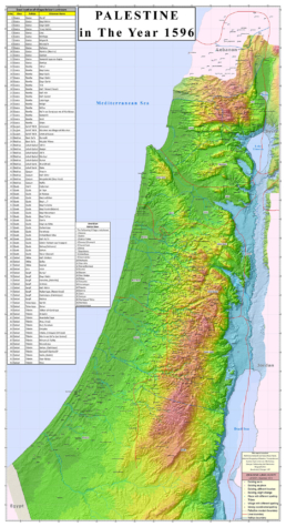
Palestine 1596
A rare map created from the Ottoman Tax Register of 1596 showing Palestine Localities in that year.

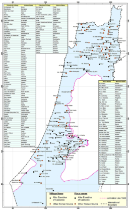
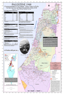
Palestine
A map of Palestine showing locations and names of original villages and localities before Al Nakba pinpointing new colonies and massacres

Beer Sheba Tribal Lands
A map of Beer Sheba showing locations and names of original tribal lands

Al-Nakba and Return
A review of Palestinian life before 1948 showing its topography, its town and villages, plantation, costumes, transport and communication, Jerusalem doorways and streets.
Al Nakba Anatomy
This is a very compelling and informative animation of the Zionist invasion of Palestine in 1948, in two-week intervals, showing the occupied areas, the depopulated villages, the expelled population and the Israeli military operations.
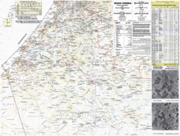
Gaza & Beer Sheba Districts 1948
A rare and detailed map showing features of their important region collated from several references.
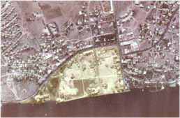
Fly Over Palestine
The lands where the refugees were deprived from returning to or seeing.
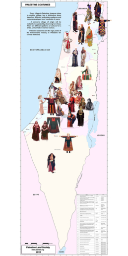
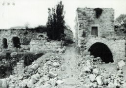
Palestine Features before 1948
A review of Palestinian life before 1948 showing its topography, its town and villages, plantation, costumes, transport and communication, Jerusalem doorways and streets.
Palestine in 1948 and 1967
A popular poster map shows village details in occupied Palestine in 1948 and 1967.